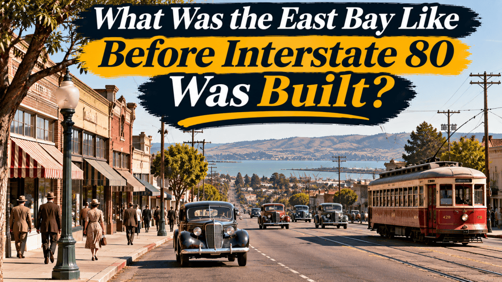
Before Interstate 80 became one of the busiest transportation corridors in the San Francisco Bay Area, traveling through the East Bay involved a different combination of local roads, streetcars, electric trains, ferries, and railroads. Communities such as Berkeley, Albany, El Cerrito, Richmond, San Pablo, Pinole, Hercules, Rodeo, and Crockett developed around their own business districts, industrial workplaces, and transportation connections.
The modern freeway did not appear overnight. It evolved from earlier highways and a series of construction projects that changed how residents traveled between communities. Understanding what existed before Interstate 80 helps explain why older East Bay neighborhoods, commercial streets, and waterfront areas look the way they do today.
The East Bay before the automobile era
Long before the development of California’s highway network, Indigenous communities inhabited the region around San Francisco and San Pablo bays. Their relationships with the land and waterways extended back thousands of years.
Spanish colonization, Mexican-era ranchos, and American settlement subsequently transformed land ownership and patterns of development. Agriculture, livestock production, waterfront commerce, and manufacturing became important parts of the local economy.
By the late nineteenth century, Oakland had become a major transportation and commercial center. Smaller communities farther north developed in connection with agriculture, railroads, shipping, and industrial employment.
Road conditions varied considerably. Many journeys that are relatively straightforward today could require slow travel over unpaved roads or coordination with train and ferry schedules.
San Pablo Avenue was a major transportation corridor
Before the Eastshore Highway was constructed in the 1930s, San Pablo Avenue served as a principal road connecting communities along the northern East Bay.
Rather than traveling on a limited-access freeway, motorists passed through established commercial areas, encountered intersections, and shared roads with local traffic. Businesses along the route had opportunities to serve travelers as well as neighborhood residents.
San Pablo Avenue became part of the national U.S. Route 40 corridor. This predecessor to Interstate 80 connected the Bay Area with communities farther inland and formed part of a much longer national highway route.
Today, portions of San Pablo Avenue remain important local transportation routes. The avenue’s older buildings, neighborhood businesses, and street patterns provide reminders of the period when regional travel depended more heavily on ordinary city streets.
How people traveled without Interstate 80
Streetcars connected East Bay neighborhoods
Electric streetcars were an important part of urban transportation in the early twentieth century. They helped connect residential neighborhoods with downtown businesses, schools, and workplaces.
The Key System developed a network that included streetcar routes, electric commuter trains, and ferry connections. Southern Pacific also operated electric passenger railway services in the East Bay.
Developers sometimes planned residential communities around convenient access to rail transportation. Commercial districts grew near busy routes, allowing residents to reach shops and other services without depending entirely on automobiles.
The Western Railway Museum preserves historical information about the Key System and its role in the development of East Bay transportation.
Ferries provided access to San Francisco
Before the San Francisco-Oakland Bay Bridge opened in 1936, ferries were essential to many journeys across the bay.
Commuters could travel by train to a waterfront terminal and transfer to a ferry bound for San Francisco. Vehicle ferries also served motorists who needed to cross the water.
A trip therefore involved more than choosing the shortest driving route. Departure schedules, connections, and time spent boarding vessels all influenced travel plans.
The waterfront was not simply a place for recreation or industrial activity. It was an important gateway between communities.
Railroads supported industry and commerce
Freight railroads connected East Bay businesses with ports, agricultural regions, and markets throughout California and beyond.
Manufacturing facilities and warehouses often developed near railway lines because access to transportation reduced the difficulty of moving equipment, raw materials, and finished products.
Passenger trains also provided alternatives for longer journeys. Although residents increasingly purchased automobiles during the twentieth century, rail transportation continued to play an important role in the regional economy.
What were West Contra Costa County communities like?
Richmond
Richmond developed into an industrial city with significant connections to petroleum refining, rail transportation, and maritime commerce. Before World War II, industrial employment already played a major role in its economy.
Wartime shipbuilding dramatically accelerated the city’s growth. Thousands of workers arrived to participate in defense manufacturing, increasing demand for homes, transportation, and public services.
This expansion was a major influence on the region’s transportation needs before the construction of the modern interstate corridor was completed.
San Pablo and El Cerrito
These communities were closely connected to the development of San Pablo Avenue. Homes, shops, restaurants, and other businesses occupied areas accessible from the main road.
As automobile travel became more common, roadside businesses gained importance. Residents could also travel through portions of the region using public transportation.
The modern freeway later diverted much of the longer-distance traffic away from local streets, although those streets remained important for neighborhood access and commerce.
Pinole, Hercules, Rodeo, and Crockett
Farther north, communities developed around different combinations of waterfront activity, agriculture, manufacturing, and railroad connections.
Pinole had roots in the Mexican rancho period and later grew into an incorporated community. Hercules became associated with explosives manufacturing, while Rodeo and Crockett developed their own industrial and commercial identities.
Crockett’s sugar industry was particularly important to the settlement’s economic history. In communities such as these, the location of a workplace, railroad station, or waterfront facility could strongly influence daily life.
Travel between towns was possible, but regional transportation depended on a network of roads and rail connections rather than a single continuous modern freeway.
The first Carquinez Bridge opened in 1927
One of the most important developments preceding Interstate 80 was the construction of the original Carquinez Bridge.
According to Caltrans, the crossing began serving travelers in 1927. It established a road connection across the Carquinez Strait between Contra Costa and Solano counties.
The bridge made it easier for motorists and commercial vehicles to continue north and east from the Bay Area. It also increased the importance of roads leading toward Crockett and the crossing.
A second bridge opened in 1958 as the interstate era was transforming the regional transportation network. The original bridge was eventually replaced by the Alfred Zampa Memorial Bridge, which opened in 2003.
The history of this crossing demonstrates that major components of the modern I-80 corridor existed well before the interstate highway program.
How the Bay Bridge changed East Bay transportation
The opening of the San Francisco-Oakland Bay Bridge in 1936 brought a substantial change to regional travel.
New approaches were needed to connect the bridge with existing roads. The City of Emeryville’s historical account explains that the Eastshore Highway was developed along the bay side of Emeryville, Berkeley, and Albany to provide a connection north toward El Cerrito.
Much of this route occupied areas created through filling along the shoreline. Its development represented an important transition toward transportation corridors designed to handle increasing volumes of automobile traffic.
For a time, the Bay Bridge accommodated trains as well as automobiles. Electric commuter rail service continued across the bridge until 1958, illustrating that the transition away from earlier transportation patterns took place over decades.
When did the Eastshore Highway become Interstate 80?
The Eastshore Highway was an important predecessor of the modern freeway, but it did not initially have all the characteristics of an interstate highway.
After World War II, California undertook projects to improve and expand regional highways. Portions of the Eastshore Highway were converted into freeway facilities with separated intersections and controlled access.
The freeway network was also extended through western Contra Costa County toward the Carquinez crossing.
On June 29, 1956, President Dwight D. Eisenhower signed the Federal-Aid Highway Act that established the major funding framework for construction of the Interstate Highway System. Existing highways and projects could be incorporated into this broader national network as they were upgraded.
The development of I-80 in the East Bay was therefore a gradual process spanning the 1930s, 1950s, and 1960s rather than a single construction event.
How the freeway changed everyday life
Commuting and residential development
Improved highway connections expanded the distances many motorists could travel between home and work. Residential development increasingly took advantage of access to freeway entrances and exits.
This contributed to changing relationships among communities. A resident could live in one city while working or shopping in another, although travel remained dependent on traffic conditions and access to an automobile.
Local businesses and commercial streets
Freeways redirected many longer-distance journeys away from established commercial corridors. Some roadside businesses adapted to serving neighborhood customers, while new commercial developments appeared near highway interchanges.
These changes did not eliminate older business districts. Instead, they altered the ways people reached them and the types of customers they could expect.
Neighborhoods and the environment
Freeway construction also introduced costs. New transportation infrastructure required land, changed connections between neighborhoods, and affected portions of the waterfront.
Traffic noise, air pollution, and the dividing effect of large roadways became important concerns for nearby communities. The advantages of faster regional travel were not experienced equally by all residents.
These consequences remain relevant when evaluating the history of freeway development.
What happened to the earlier public transportation system?
The expansion of automobile travel occurred alongside changes to privately operated rail and bus services.
The Key System discontinued its remaining transbay trains in 1958. AC Transit began operating in October 1960 after acquiring the former private transit system.
Public transportation did not disappear from the East Bay, but buses increasingly replaced earlier rail services. BART later introduced a new form of regional rail transportation beginning in the 1970s.
The East Bay’s transportation history is therefore not a simple story of trains being replaced permanently by cars. Different modes have continued to evolve in response to regional growth and changing public needs.
Frequently asked questions
What road did people use before Interstate 80?
San Pablo Avenue was a major route before the construction of the Eastshore Highway. The Eastshore Highway itself subsequently became a predecessor of the modern freeway.
Was there an interstate highway in the East Bay before 1956?
The region already had highways, bridges, and freeway projects before the federal interstate funding program established in 1956. These facilities helped form the foundation of the later Interstate 80 corridor.
Did East Bay residents travel to San Francisco by ferry before the Bay Bridge?
Yes. Ferries carried passengers and, on some routes, automobiles across the bay. Electric trains connected commuters with ferry terminals.
When did the original Carquinez Bridge open?
The first Carquinez Bridge opened in 1927, providing a highway connection between Contra Costa and Solano counties.
Remembering the East Bay before Interstate 80
The East Bay before Interstate 80 was already a complex region of residential communities, industrial workplaces, commercial streets, railways, and waterfront transportation facilities.
The arrival of the modern freeway transformed travel and development, but it did not erase the history that came before it. Older roads, historic buildings, railway corridors, and neighborhood centers continue to reflect earlier patterns of everyday life.
Understanding that history offers a different perspective on familiar places. Beneath the modern transportation network lies the story of generations who built communities, traveled to work, and established their lives long before Interstate 80 became a defining feature of the East Bay.
Leave a Reply